You're staring at your phone, watching a little bus icon creep toward your street. "Arriving in 4 minutes," the app says. Somewhere in the back of your mind, a question forms: is the driver looking at a GPS too, or is something else making this possible?
Most parents and district staff lump two separate technologies into one idea. GPS-based tracking has become the norm across school transportation — 68% of responding public school districts now use rider-tracking or parent apps, up from just 48% the year before.
But that "bus arriving in 4 minutes" alert has almost nothing to do with what the driver personally checks. This guide breaks down exactly what runs on a bus, how location data travels from satellite to smartphone, and what that means for drivers, parents, and transportation staff.
Key Takeaways
- GPS hardware runs automatically on most modern buses, independent of driver action
- Driver navigation varies by district — some use paper routes, others get tablet turn-by-turn
- Location data flows through satellite, cellular, and cloud layers
- Tracking supports parent visibility, safety accountability, and Medicaid documentation, not just locating the bus
Do Bus Drivers Use GPS? Separating Navigation From Tracking
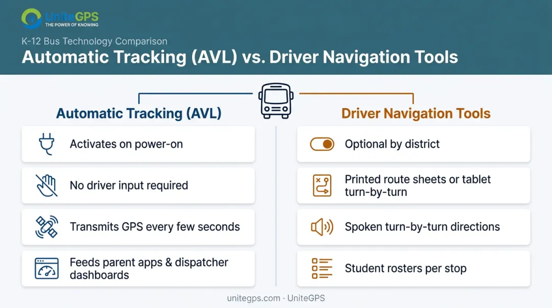
Yes, but in two distinct ways. There's an automatic tracking system that runs regardless of what the driver does, and there's optional driver-facing navigation that varies district by district. Confusing the two is where most of the questions start.
The Automatic Tracking System (Runs Without Driver Input)
An Automatic Vehicle Location (AVL) unit sits on the bus and starts transmitting GPS coordinates the moment the vehicle powers on. No button. No app to open. Zero action required from the driver.
This always-on hardware layer is what feeds the parent-facing "where's my bus" apps and the dispatcher dashboards back at the district office. On UniteGPS's Crosswalk platform, for example, that unit sends position updates every 5 seconds. It keeps working even when the ignition is off, giving districts visibility into a vehicle around the clock, not just during routes.
Driver-Facing Navigation Tools (What Drivers Actually See)
Plenty of bus drivers still rely on printed route sheets and memorized turns. That's not a technology gap. It's simply how many districts have always operated, and for routes drivers have run for years, it works fine.
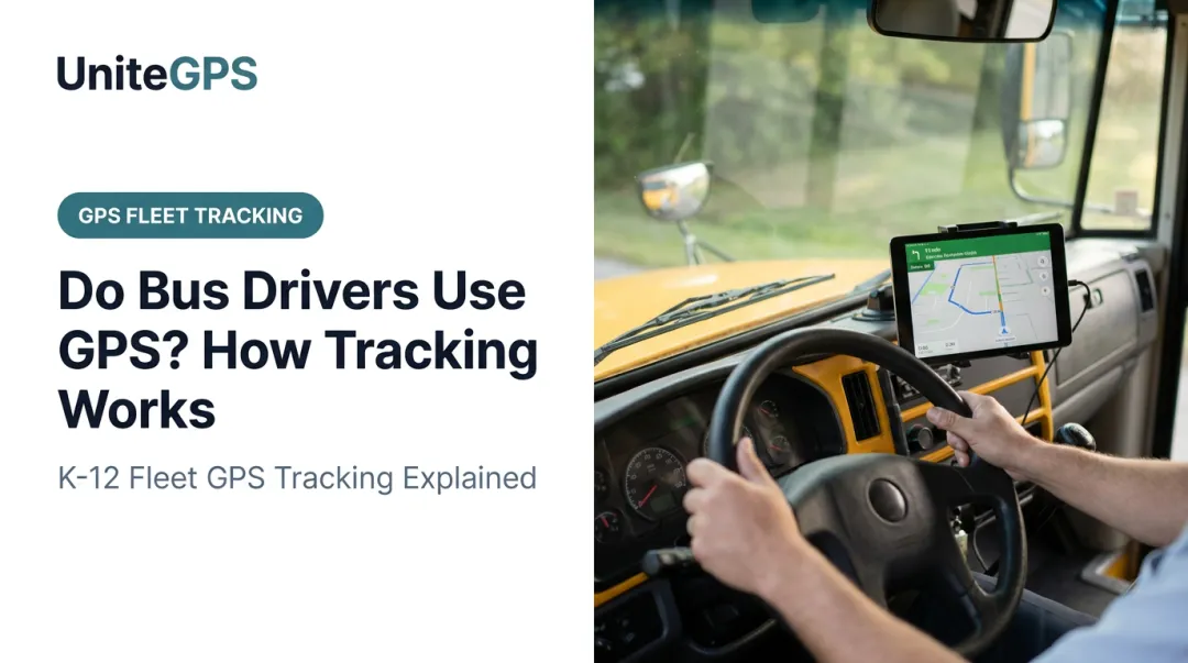
A growing number of districts now equip buses with tablets instead, offering:
- Spoken turn-by-turn directions so drivers keep their eyes on the road
- A full route map showing every remaining stop
- Student rosters tied to each stop location
These tools matter most for substitute or new drivers who don't know a route by heart. Fewer wrong turns, less stress, more consistent service. Here's the part people miss: a driver not looking at a navigation screen tells you nothing about whether the bus is being tracked. Those two systems operate completely independently.
How Does School Bus GPS Tracking Actually Work?
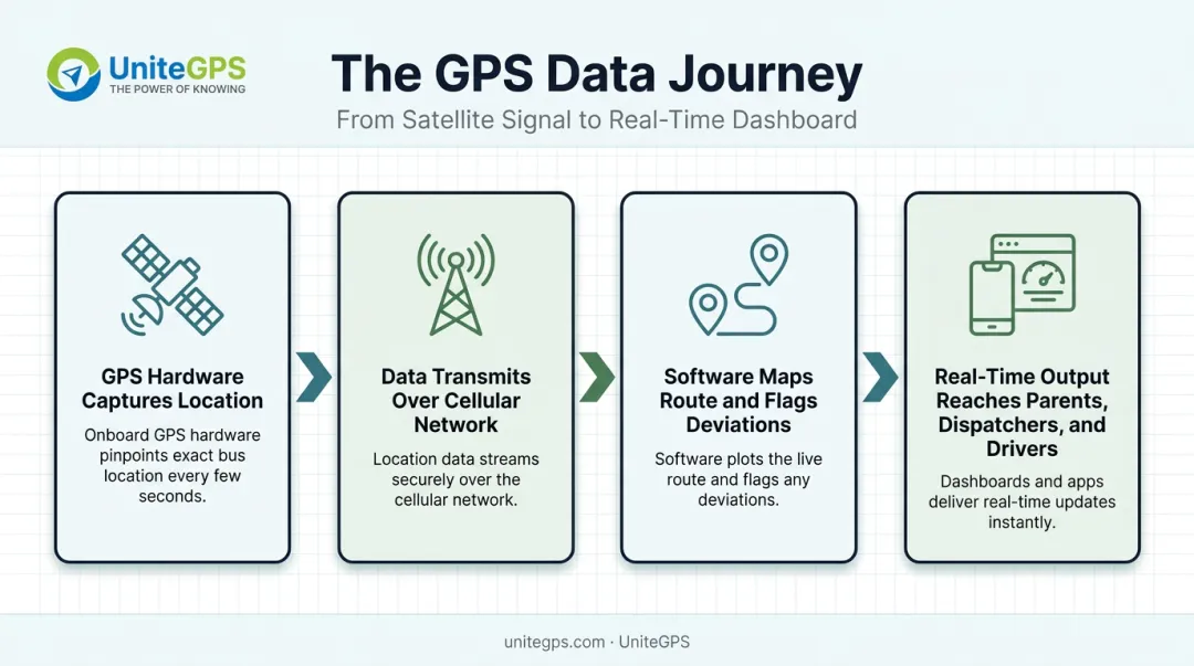
Tracking works through a defined pipeline, moving from a satellite signal to a parent's phone screen in a matter of seconds.
Step 1: GPS Hardware Captures Location
A small GPS receiver, sometimes built into a driver tablet, continuously receives signals from orbiting satellites to calculate coordinates, speed, and heading. This happens automatically and continuously once the vehicle powers on. No manual step, no driver interaction required.
Step 2: Data Transmits Over the Cellular Network
The device sends location data to a cloud platform at frequent intervals, using cellular networks much like a smartphone does. Update frequency varies by vendor: some systems refresh every few seconds, while others operate on a 30-60 second cycle for dispatch-facing data.
One real limitation worth asking vendors about directly: poor cellular coverage in rural service areas can create tracking gaps. Some systems store data locally and sync once connectivity returns, which means the position history catches up, but live tracking pauses temporarily.
Step 3: Software Maps the Route and Flags Deviations
The platform overlays live coordinates onto the planned route and stop schedule, comparing actual position against expected timing. When a bus falls behind or drifts off its assigned path, the system flags it through color-coded dashboards, geofence alerts, or automated speed and idle notifications.
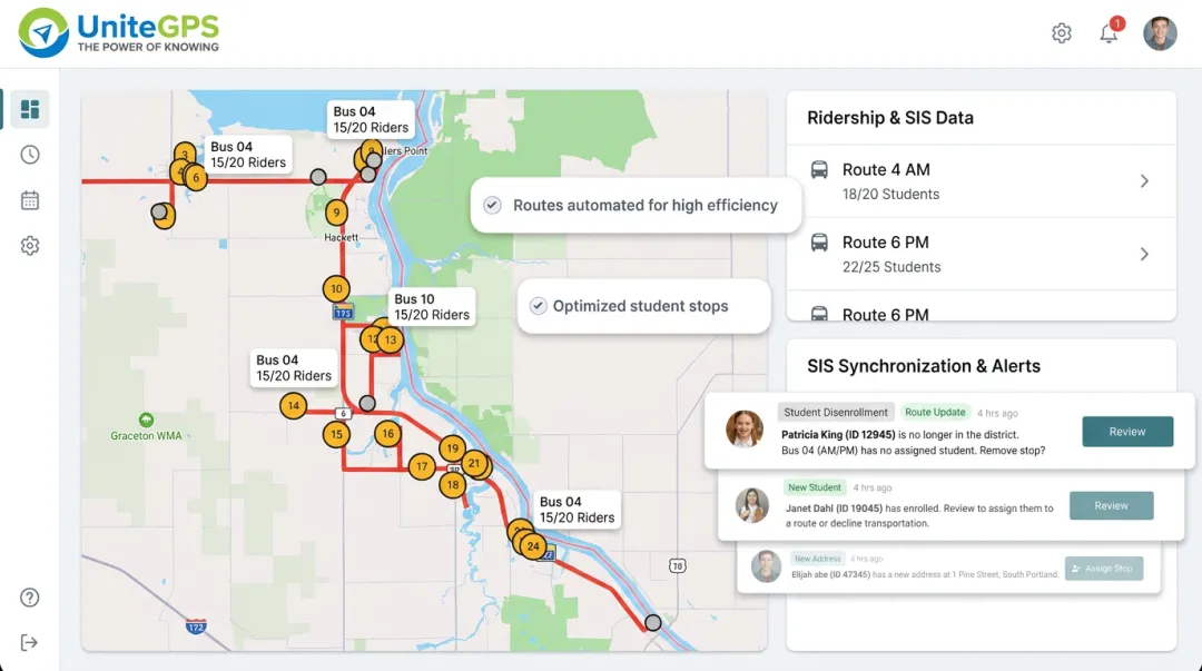
Stronger platforms sync this with Student Information Systems so administrators can cross-reference bus location with expected ridership. This is the kind of integration Crosswalk was built to automate, syncing directly with PowerSchool, Skyward, and Infinite Campus so enrollment changes update routes without anyone re-entering data.
Step 4: Real-Time Output Reaches Parents, Dispatchers, and Drivers
Processed data shows up in three places at once:
- Parent apps show ETAs and confirm boarding in real time
- Dispatcher dashboards provide fleet-wide oversight of every vehicle
- Driver tablets surface live navigation and route alerts
The measurable result districts consistently point to is fewer phone calls to the transportation office. As Tim Lyons, Director of Transportation at Benton Community School District, put it: "If a parent calls saying that the bus didn't stop, we can look and see that they were there. It has made a huge difference in our district."
Who Relies on This Tracking Data
Parents use a companion app to see their child's bus in real time and get confirmation when a student boards or exits. Districts running scan-based ridership systems can send "scan-on/scan-off" alerts, so a parent knows the moment their kid is on the bus, not just that a bus is nearby.
Transportation directors monitor entire fleets from a single dashboard, managing detours and emergencies as they unfold. As Derek Muench, Director of Parking & Transit at Shoreline Metro Transit, puts it:
"Staff are able to make timely operational decisions without impacting service simply by monitoring the fleet's real-time performance." — Derek Muench, Director of Parking & Transit, Shoreline Metro Transit
District administrators lean on the same GPS-verified data for a very different purpose:
- Supporting Medicaid reimbursement claims with timestamped ridership records
- Documenting IEP transportation compliance
- Producing audit trails for state reporting requirements
None of this requires a separate system. The same location data that shows a parent where the bus is also becomes the paper trail a finance office needs months later.
Why GPS Tracking Matters for Districts and Transit Agencies
Two benefits keep coming up in conversations with transportation directors: cost control and accountability.
- Route optimization trims total miles driven using historical GPS data, cutting fuel costs and driver hours without touching student safety.
- Safety and accountability rely on GPS logs proving whether a driver followed the assigned route, useful during incident reviews or parent complaints.
- Fewer parent calls reach the transportation office once real-time and historical location data answers most questions before they're asked.
UniteGPS offers a free Route Optimization Study that builds a district-specific savings plan from actual route history, rather than relying on generic industry averages that may not reflect a district's road conditions or bell schedules.
UniteGPS built its Crosswalk platform to address both needs at once: one system combining GPS tracking, routing, ridership tracking, and SIS synchronization, built specifically for K-12 districts and small-to-medium transit agencies. Districts can test it through a 90-day free trial with no credit card required, with routes built at no cost during onboarding.
Conclusion
Buses are tracked continuously through automatic GPS hardware the moment they power on. Driver-facing navigation is a separate, optional layer that varies from fleet to fleet — some drivers still work off memorized routes and printed sheets, others follow a tablet.
For districts and agencies evaluating technology, the practical takeaway is simple: look for one integrated platform, like UniteGPS, rather than stitching together separate tracking and navigation tools from different vendors.
Frequently Asked Questions
How do bus drivers know where they are going?
Drivers rely on a mix of memorized routes, printed route sheets, and increasingly, tablet-based turn-by-turn navigation. Which method a driver uses depends entirely on the district's technology, not on the driver's experience level.
How does Google Maps know I'm on a bus?
Consumer mapping apps typically infer "on a bus" status by reading phone motion sensors and speed patterns, then matching that against published public transit schedules. The bus itself isn't communicating with your phone.
Does every school bus have GPS tracking installed?
Adoption is widespread but not universal — it depends on district budget and vendor contracts. Nationally, 87% of vehicles in APTA's 2025 transit database had automatic vehicle location (AVL) installed, though that figure spans public transit and school fleets alike.
Can parents track their child's school bus in real time?
Most GPS-enabled districts offer a parent app showing live bus location and stop ETAs. Some platforms go further, adding boarding and deboarding confirmations tied to student scans.
Is student GPS tracking data kept private and secure?
Reputable platforms maintain FERPA compliance, meaning a formal data processing agreement, encrypted transmission, and strict limits on what student information gets collected. UniteGPS, for instance, never accesses grades, health records, or IEP details.
How accurate is GPS tracking on a moving bus?
Under normal conditions, GPS accuracy typically falls within about 4.9 meters, or 16 feet, under open sky, according to GPS.gov. Accuracy can worsen near buildings, bridges, and dense tree cover.