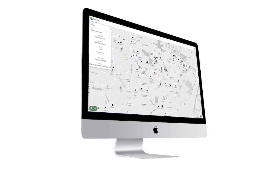
REAL-TIME FLEET MAP
UniteGPS Fleet's real-time tracking system provides instant visibility of your entire
municipal fleet. Our live GPS map enables efficient vehicle dispatching and
optimal route planning with up-to-the-minute location data for improved
emergency response coordination and resource deployment.
Live GPS Tracking
- Monitor the exact location of every vehicle in your municipal fleet in real-time
- View vehicle positions, status, and movement throughout your service area
- Filter map view by department, vehicle type, or activity status
Efficient Dispatching
- Quickly identify the nearest available vehicles for any task or emergency
- Improve response times with instant location awareness
- Optimize route planning for all municipal departments
Vehicle Status Monitoring
- Access key vehicle information including current speed and engine status
- View department assignments and garage locations for each vehicle
- Track active vs. inactive vehicles with customizable time thresholds
Benefits of Real-Time Fleet Tracking
- Improved emergency response coordination with instant location awareness
- Enhanced resource deployment for maximum operational efficiency
- Better interdepartmental coordination through unified vehicle visibility
- Reduced response times for essential municipal services
- Optimized routing to minimize unnecessary mileage and fuel consumption
- Complete situational awareness for management and dispatchers
Advanced Tracking Capabilities
Advanced Filtering
Customize your map view with filters for vehicle activity, departments, vehicle types, or other criteria. Focus on specific segments of your fleet to manage resources more effectively and simplify dispatching during busy periods.
Emergency Response
Improve coordination during emergency situations with instant location data for all essential vehicles and resources. Determine the closest available units to any incident location for faster response times and better public safety outcomes.
Multi-Department Integration
View vehicles from all municipal departments in a single unified interface. Break down operational silos with cross-departmental visibility while maintaining appropriate access controls and filtering capabilities for different user roles.
Historical Route Playback
Review vehicle movements and activities with detailed historical playback. Verify completed work, analyze response patterns, and validate service delivery with precise route and time data for any vehicle in your fleet.
Simple Implementation Process
1. Hardware Installation
Quick and non-invasive GPS device installation across your municipal fleet
2. System Configuration
Setup of department groupings, user accounts, and display preferences
3. Staff Training
Training for dispatchers, administrators, and department managers
4. Ongoing Support
24/7 technical assistance and regular system updates
Ready to gain complete visibility of your municipal fleet?
Schedule a demo to see how our real-time fleet map can improve your response times, enhance coordination, and optimize your municipal operations.